The Barcoo Way
Duration: 9 Days from Tambo to Windorah
So you’ve had a taste of the Outback and know that you are keen to see more. This adventure drive has been developed by the locals who live in the towns along the famous Barcoo River. It’s designed for outback explorers keen to dig deep and discover the real deal. Interested? Well read on and we’ll take you there.


Day 1 - Getting to Tambo
Your Barcoo Way adventure drive begins in Tambo, the oldest town in the west! Well okay…..Western Queensland. Tambo is also the nearest town to the confluence point of the Barcoo River, the theme of this drive.
Tambo is about a 862 km drive north west of Brisbane along the Landsborough Highway. However, if you are looking for a spectacular entrance into Tambo, we’d recommend that you follow the Dawson Development Road from Springsure. This is around a 221km drive along a mix of sealed and unsealed surfaces. This section of the drive forms the top section of Tambo’s Wilderness Way 4WD loop drive. You’ll understand why this area of spectacular rugged beauty is known as the ‘Rooftop of Queensland’ as you pass by deep gorges and vast chalk-coloured cliff lines.
If you are keen to really get off-road and explore Salvator Rosa National Park on the way to Tambo, then follow the alternative route below:
- About 144km west of Springsure along the Dawson Development Road, you’ll reach the Salvator Rosa National Park turn-off. From there it is about a 50km drive via Cungelella Road to the park entrance. The road becomes more of a station track for about 24km until you spot the signs for Salvator Rosa.
- From Salvator Rosa National Park to Tambo, you rejoin the Wilderness Way drive and follow the unsealed Mount Playfair road back to Tambo. This route is for high clearance 4WD vehicles only.
Wilderness Way
Explore the 'rooftop of Queensland' with a self-drive tour of Tambo's stunning Wilderness Way. View a range of spectacular natural sceneries like nowhere else!
Tambo
Day 2 - Tambo
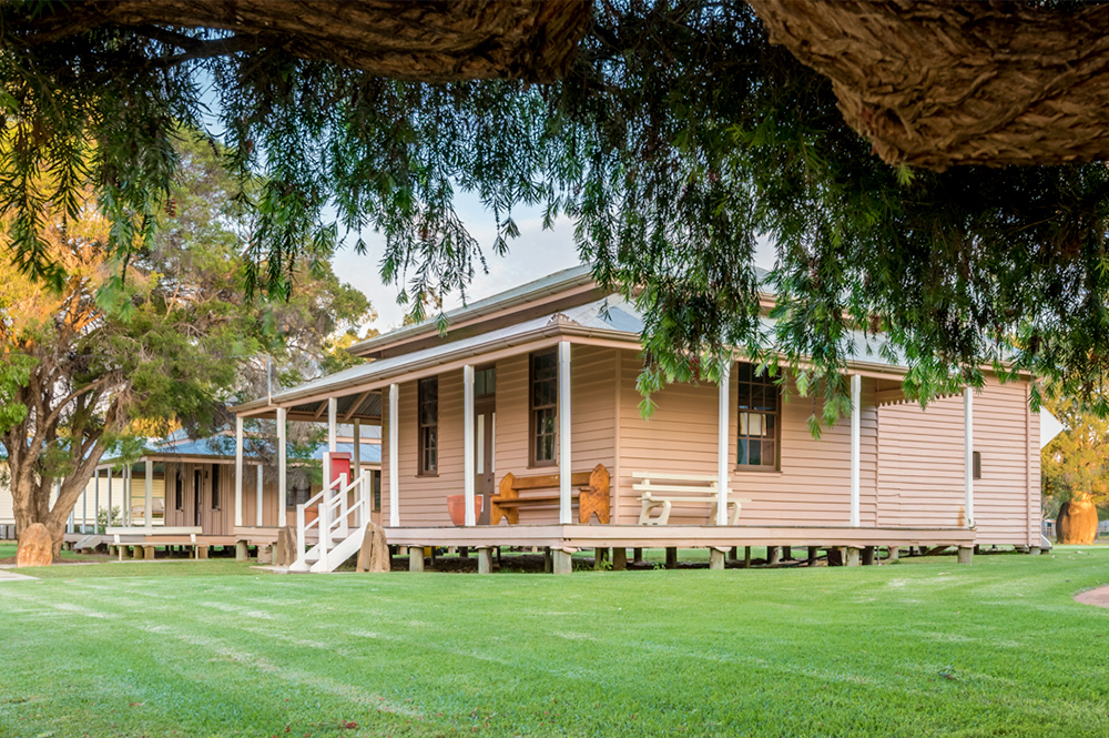
As you arrive in Tambo you’ll pass beautiful heritage buildings and streets lined with native bottle trees. Make time to wander the main street, discovering the stories of the Heritage Precinct. Tambo played a vital role in the early telegraph system linking the north of Australia with the south. You’ll discover a whole host of post and telegraph artefacts. You can even see and hear a Morse code message in operation!
See the latest exhibition at the Grassland Art Gallery. This beautiful centre hosts locally produced and curated displays featuring a mix of regional and touring exhibitions. Just down the street is the famous Tambo Teddies workshop where you can see these cuddly favourites come to life.
Continue to the southern entrance of town to the Tambo Dam and Parklands. The dam provides a wonderful habitat for birds, so it’s a great spot for ‘twitchers,’ particularly early mornings or late afternoons. Enjoy a picnic, a relaxing walk or a refreshing swim. When the dam is full, expect to see locals skiing and tobogganing.
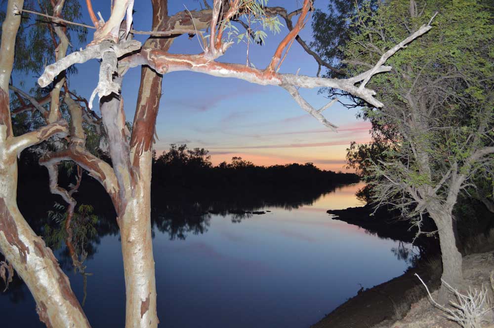
Stroll the Coolibah Walk on the banks of the Barcoo River. The river with its many swimming holes and fishing spots is popular with locals and visitors alike. Just over the bridge on the Tambo-Alpha road, there is a popular local fishing hole…..but you didn’t hear it from us!

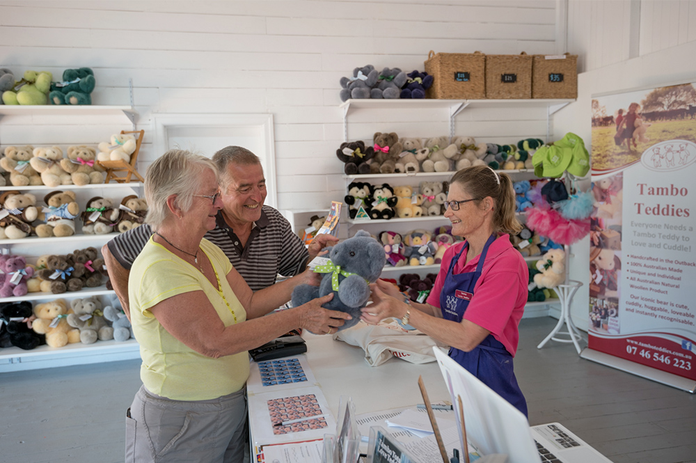
Tambo Teddies
Find your perfect cute & cuddly souvenir at Tambo Teddies! Learn about how the company came to be and watch your furry friend being brought to life.
Tambo
Day 3 - Tambo to Blackall – 102km
Begin your drive to Blackall. Choose to travel the direct route via the Landsborough Highway and you will travel around 100km to Blackall. If you are keen for a bit of an off-road adventure, then consider taking a 4WD side trip along the Langlo-Adavale Track.
So… you have arrived in Blackall, our second town along the Barcoo Way drive. Blackall is home to the legendary Jackie Howe. This national icon sheared 321 sheep in seven hours and 40 minutes, using blade shears at Alice Downs near Blackall. Not a bad effort. They say it would be equivalent to the Roger Federer 17 grand slams!
While in Blackall, we recommend that you take a guided tour of the Blackall Woolscour, the only fully intact steam-powered wool washing plant left in Australia. Take a wander through the displays at Ram Park. It really does bring Blackall’s colourful history to life.
What better way to end the day than soaking tired bones in mineral rich artesian water. Spend a couple of hours at the Blackall Aquatic Centre known for its therapeutic benefits…. stress relief, injury recovery, improved mobility……eternal youth. Well maybe eternal youth is a long-shot! Let’s just say it’s the perfect place to simply relax and soak up the Outback experience.


Blackall Woolscour
Discover history in action at the Blackall Woolscour, the last remaining steam operated wool washing plant in Australia. Make time to explore this living museum.
Blackall
Day 4 - Blackall to Isisford
Leaving Blackall, drive north on Barcaldine Road for 18km and turn left at Avington Road. Please be mindful the road is now dirt through to Isisford. Continue along this road for another 44km. You are now passing through some of the richest grazing pastures in Western Queensland, prime sheep and cattle country.
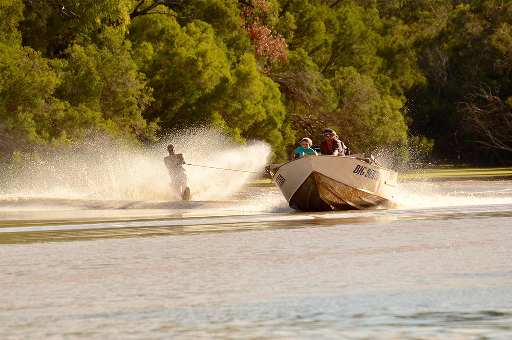
Follow the Blackall-Isisford Rd and keep your eyes peeled for a little track leading off to towards the Barcoo River. When you spot an old Woolshed on the left hand side of the road, you’ve reached Avington Waterhole. Avington is just one of 22 permanent waterholes on the Barcoo River. Home to 14 species of native fish, it’s fair to say that fishing is a popular past-time. Throw a line in, go for a paddle or check out some of the other nearby waterholes.
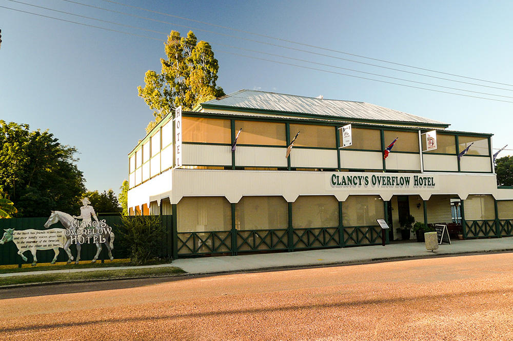
Drive another 64km to a little town on the banks of the Barcoo called Isisford. With your first glimpse of the town’s streetscape you could be forgiven to think you had stepped back in time to the 1800s. This part of the region, often referred to as the ‘Outer Barcoo’ has been the inspiration for some of our more note-worthy poets. Banjo Paterson spent much time at Isisford and the environment provided inspiration for some of his work including Clancy of the Overflow and A Bush Christening. The two-story (now unused) building in the main street is called Clancy’s Overflow Hotel. Originally called Power’s Club Hotel, the pub’s name was changed in 1965 by new owner Glen Clancy in honour of Banjo’s famous poem. Here’s a quirky fact…..it was the first far west hotel to have electricity connected!


Fishing Competition
Take part in a true outback fishing event at the Isisford Fishing Competition held annually in July at Oma Waterhole. Join in the fun and compete for cash prizes.
Isisford
Day 5 - Isisford to Yaraka
It may come as a surprise to some that Isisford lays claim to a 98 million year old crocodile. Crikey! It’s official name is Isisforia duncani and you can see a replica of this beauty at The Outer Barcoo Interpretation Centre. At this point we should stress that there are NO crocodiles in the Barcoo River, but there is excellent fishing. Anywhere downstream from the Weir is said to be ideal. One of the most popular spots is the Oma Waterhole just 16 km along the Isisford-Yaraka River Road.
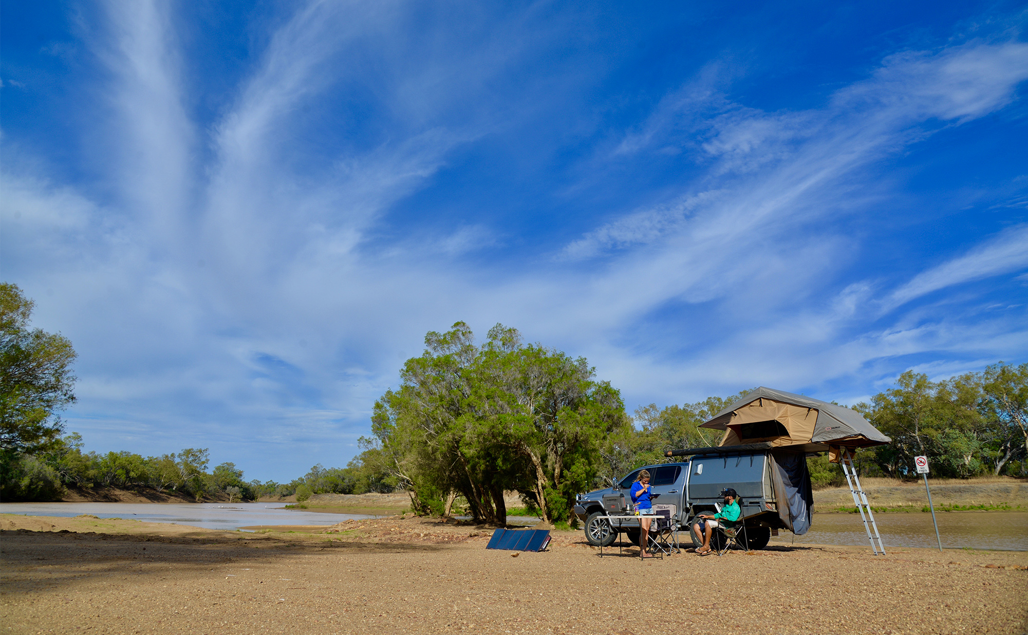
Every July Oma Waterhole is the scene of a fishing frenzy with keen anglers travelling from far and wide for the chance to take out the top prize by reeling in ‘the big one’. The fish that is longest in length is the winner of the Isisford Fishing Competition. If you enjoy camping, Oma Waterhole has good facilities and is a great option when exploring the area around Isisford. This tranquil area on the river is great for fishing, water activities with boat ramp access.
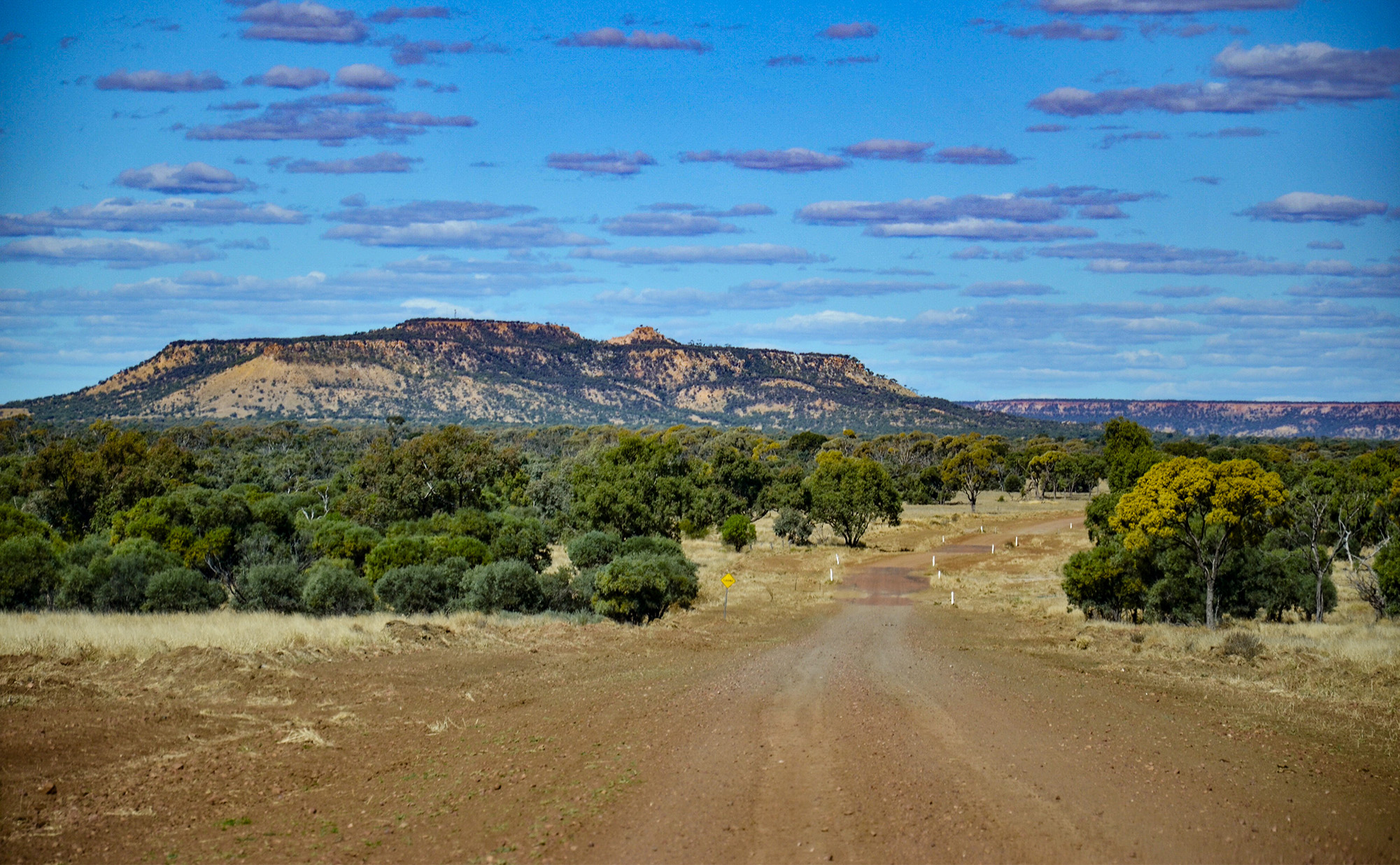
From Oma Waterhole, you can follow the Emmet-Yaraka road for 103km through to Yaraka (mostly sealed) or you can get the red dust under your tyres with an 87km adventure drive via the Isisford-Yaraka River Road. If you’re a keen photographer, we recommend taking the Emmet-Yaraka to capture stunning views of the Yang Yang Ranges and Mt Slowcombe as your arrive into town.
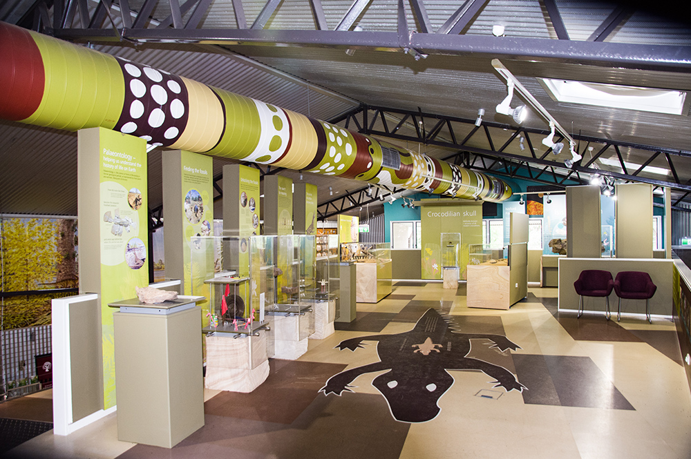
Interpretation Centre
If you want to learn more about Isisford and it's surrounds, this is the spot to do it. Housing displays of fossils, fauna, reptiles and birds that have lived in this region.
Isisford
Day 6 - Yaraka
It’s fair to say that Yaraka is small town with a population that could fit in a small bus. But it hasn’t always been that way. Back in 1917 is began as a rail head for the planned Great Western Railway. The Emmet to Yaraka section was completed but the line to Windorah didn’t go ahead. Yaraka became the ‘End of the Line’ in this story with the rail head closing for good in 2005.
Yaraka was the point where wool bales were brought to be loaded on the rail wagons and sent to market. Given that it was once part of the giant Milo sheep station, Yaraka was well known for its wool production. As with other parts of Outback Queensland, Yaraka’s wool production has been hugely affected by wild dogs destroying their flocks. The district still produces fine micron wool, but there has been a gradual switch to cattle grazing.
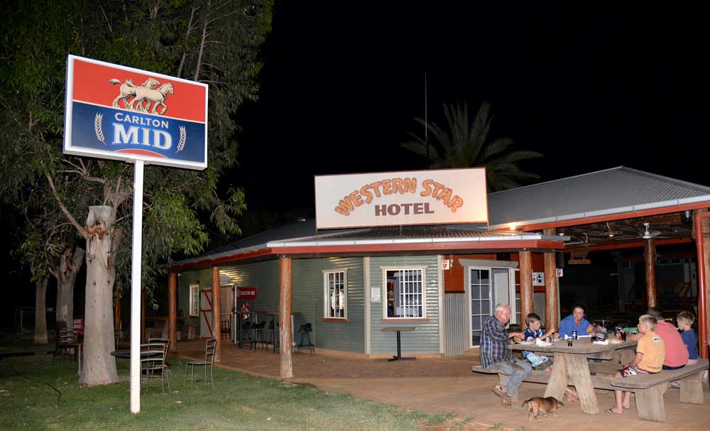
There’s many a visitor that extends their stay in Yaraka because they love the great outback hospitality of the local publicans. Many a traveller has been found relaxing in the welcoming beer garden with views to the beautiful Yang Yang Ranges. The Hotel also provides accommodation and meals.
An absolute must when in Yaraka is to toast the sunset at nearby Mt Slowcombe. Join the daily sunset tour operated by Yaraka Hotel for the short 8km drive to the lookout. You won’t be disappointed. This place just oozes awesomeness from every angle of its 360 degree vista. It’s a sealed road all the way to the top, so it’s accessible to all vehicles, although it’s best to leave the caravan back at the hotel. Make use of the shaded free BBQ facilities and loo with a view while you’re there.
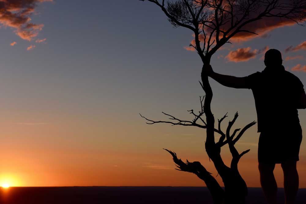

Sunset Tour
Grab some drinks and snacks ready to join the popular Sunset Tour to spectacular Mt Slowcombe. Soak up one of the top 10 sunsets in the Outback.
Yaraka
Day 7 - Yaraka to Welford National Park
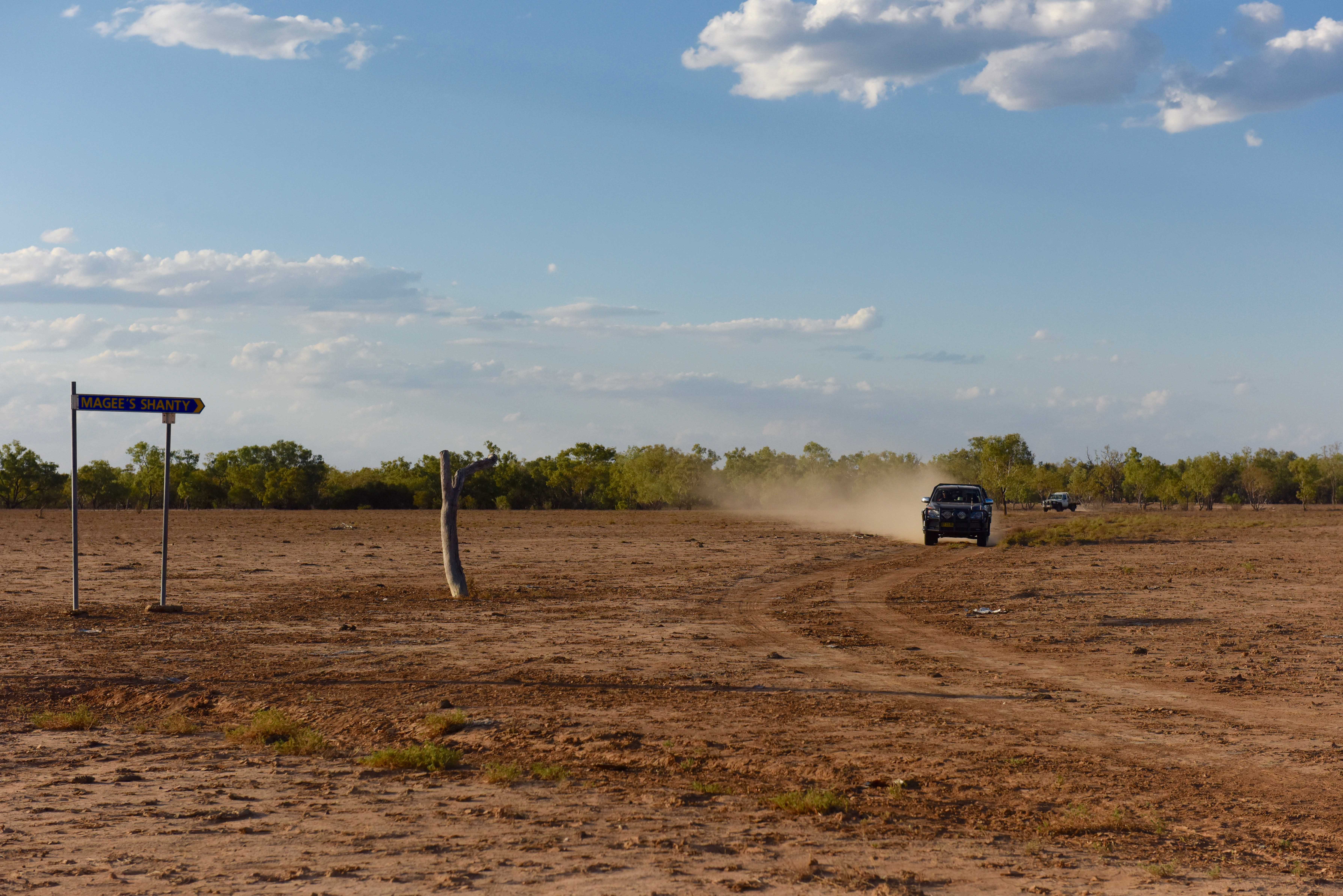
Today you’ll visit the site of a historic shanty in a town…..that wasn’t. Yes that’s right. The gazetted town of Welford was a casualty of the incomplete Great Northern Railway project. The original surveyors pegs are still there from 100 years ago.
From Yaraka follow the Yaraka-Retreat road south west for 45km and turn right onto Wandsworth Road. Then drive 5km along a gravel bush track to the ruins of Magees Shanty. Legend has it that Banjo Patterson wrote his iconic poem ‘A Bush Christening’ about an event that happened at this very site. To show their support, a handful of locals have also ‘had their heads wet’ here. A few hundred metres east of the Shanty is the lonely gravesite of Richard Magoffin. Richard was a gold prospector who perished in search of water for his horses during a severe dust storm in the late 1800s. Ironically, he was just a few hundred metres from the Barcoo River when he died.
Next stop is Welford National Park. Head back to the Yaraka-Retreat Road and drive a further 45km southwest to The Retreat (turnoff). Drive 3km along the Jundah-Quilpie Road to the Barcoo River Crossing. The perfect place to boil the billy, wet the line or watch the native birdlife at play. From the crossing it’s just a short drive into Welford National Park and your overnight campsite at Little Boomerang Waterhole. Find out more about things to do in Welford National Park here.

Magoffin's Grave
Across a vast clay pan, not far from the centre of Yaraka, you can find the grave of Richard Magoffin who perished from thirst only a few hundred metres from the river.
Yaraka
Day 8 - Welford National Park to Windorah
From Welford, travel back across the Barcoo River Crossing along the Jundah-Quilpie Road to the Retreat. Turn right and drive for 56km on the mostly gravel Hammond Downs Road. As you near Windorah, you’ll notice the landscape starting to change. From the black soil plains and mulga country to the spinifex and sandhill ‘desert country,’ this is an incredibly scenic drive.
At Hammond Downs, turn right on to the Diamantina Development Road and then it’s just 17km into Windorah. You’ll know doubt be ready for a great meal, a cool ale and some great outback company. Well, you’ve come to the right place. The people of Windorah are renowned for their hospitality. Make your first port of call the Visitor Information Centre, hook up to the free wifi and reconnect with the family back home.
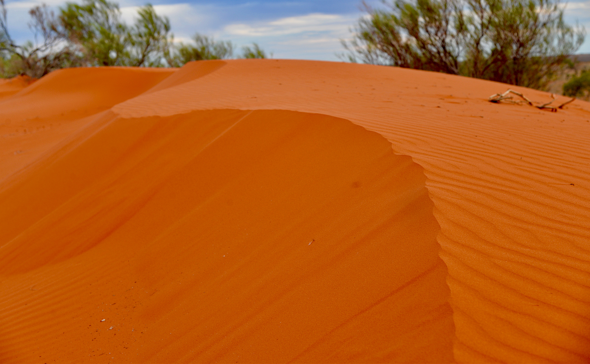
Just 12km west of town are the Windorah Sandhills. These stunning red dunes are awesome by day, but the real magic happens as the sun goes down. So it’s a good idea to time your visit for just on sunset. And, make sure you bring supplies of BYO drinks and nibbles. This sunset will be a night to remember.
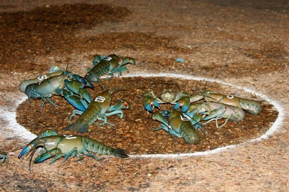
Yabby Races
Fire up your punting skills at the International Yabby Races. This event is a 'must do' in the lead up to the iconic Birdsville Races further down the track.
Windorah
Day 9 - Windorah
You’ve reached the end of the Barcoo Way here in Windorah, but there’s still plenty to see while in town. An interesting drive down to the Cooper Creek is via the Nature Drive. This unsealed track complete with interpretive signage will lead you on a self-guided native plant discovery tour.
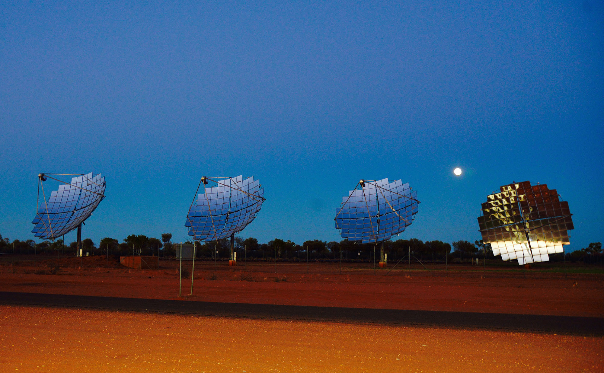
Around 2km out of town it’s pretty hard to miss the five dazzling mirror dishes of the Windorah Solar Farm. There’s a viewing area and plenty of information on how this farm came to be. Another interesting attraction is the Whitula Gate Museum featuring an original slab hut built as a boundary riders hut. It’s just behind the Visitor Information Centre. Find out more on show at the Museum here.
You may have passed the Cooper Creek on the way into town. Did you know that it’s the only place in the world where two rivers merge to form a creek? The Thomson and…… you guessed it, the Barcoo, merge around 40 kms upstream of Windorah. From here, the waters of the Cooper flow to Lake Eyre.
What a journey!